Business Details
38 Years
experience
Trusted Geospatial Software Solutions
Founded in 1988, our company has established itself as a leader in geospatial data applications through innovative software solutions. Our founder, Dr. Erick Malaret, brings over 35 years of expertise in signal and image processing, cultivated through advanced research at Purdue University and pioneering contributions to NASA missions. By focusing on the entire geospatial data lifecyclefrom sensor data capture to end-user analysisweve developed groundbreaking tools like the MSHELL engine and network-centric architecture that enable efficient data management and reuse. Our GSA contract underscores our commitment to government clients, providing trusted solutions for high-volume data environments. With decades of experience in mission-critical support, we deliver custom interfaces and round-the-clock data processing.Our software has been integral to over 30 major scientific missions, including Mars exploration and lunar mapping. Continuously enhancing our tools to meet evolving scientific requirements, we ensure our clients maintain precision and efficiency in geospatial analysis. Our proven track record bridges academic rigor with practical application, making complex data accessible for researchers, educators, and mission planners. Transparency in operations and a client-focused approach have solidified our reputation as a trusted partner in geospatial innovation. We remain committed to advancing technology that meets the dynamic challenges of planetary science and environmental analysis.
Services
Geospatial Software Development
Mission Program Support
24/7 Image Processing
Data Customization
GSA Contract Services
Details
- Year established: 1988
Highlights and features
- We have over 30 years of experience in geospatial software development.
- Our team includes pioneers in sensor-to-desktop data processing architecture.
- We hold a General Services Administration (GSA) contract for government services.
- We provide 24/7 data and image processing capabilities for mission-critical missions.
- Our tools power over 30 NASA and Department of Defense geospatial missions.
Associations and certifications
- General Services Administration (GSA)
Services
Geospatial Software Development
We engineer specialized geospatial software solutions like the MSHELL processing engine and PIPE network-centric systems. Our tools enable end-to-end data analysis from sensor inputs to mission-critical insights. Continuous development over three decades ensures compatibility with evolving scientific requirements.
24/7 Image Processing
Our facility provides continuous data processing for planetary missions with automated calibration and product assembly. We ensure uninterrupted access to critical datasets for global scientific communities. Redundant systems maintain data integrity and availability.
Mission Program Support
We design ground data systems architecture and operational workflows for space missions. Our teams manage telemetry conversion and data distribution processes. End-to-end support covers mission planning through execution and archival phases.
Data Customization
We create tailored user interfaces for complex datasets that simplify access for scientists and mission planners. Custom visualization tools enhance data interpretability. Our solutions integrate with existing institutional infrastructure.
GSA Contract Services
As GSA contract holders, we provide vetted geospatial solutions to federal agencies. Our offerings include software licensing and specialized services for defense and civil space programs. Contract pricing simplifies procurement processes.
People
Dr. Erick Malaret
Founder
Dr. Malaret founded ACT in 1988 with expertise in image processing from Purdue University. He developed core geospatial algorithms and led software development for NASA missions. His leadership focuses on advancing data lifecycle management solutions.
Questions
What geospatial software solutions does ACT offer?
We provide the MSHELL engine, PIPE servers, and REACT desktop tools for comprehensive data processing, visualization, and analysis.
How does ACT support scientific missions?
We develop mission-specific ground data systems and 24/7 processing services for planetary exploration and environmental monitoring.
What expertise does ACT bring to geospatial analysis?
Our team has over 35 years of experience in sensor-to-user data architecture and image processing algorithms for NASA missions.
Is ACT certified for government contracts?
We hold a General Services Administration (GSA) contract for geospatial software and services.
Can ACT customize geospatial tools for specific projects?
Yes, we create tailored interfaces and workflows to meet unique mission requirements.
What planetary missions has ACT supported?
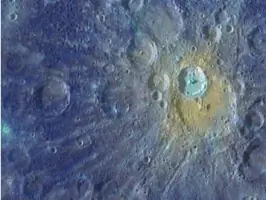
Our tools have powered Mars exploration, lunar mapping, Mercury observations, and comet research missions.